
Walk a Clarksburg Street
No single official roll lists everyone on a Clarksburg street. The strongest method builds a chain from the address to a parcel, then to recorded owners and dated household sources. Ownership is public through the Harrison County assessment and deed systems. Occupancy takes more care. A voter record, old city directory, census sheet, or newspaper item may associate a person with an address on a specific date, but none should be stretched beyond its source and year.
- Standardize the street, unit, city, and ZIP with the USPS lookup. Keep every old spelling or number as a separate search form.
- Find the situs address in MapWV, then record the Root Parcel ID, district, map, parcel, suffix, and listed owner.
- Compare that result with the Harrison County Assessor. Browse nearby parcels in GIS to see the whole block.
- Search the county clerk index by grantor and grantee. Match book, page, legal description, and parcel details before linking a deed.
- For a dated household clue, check authorized voter data and ask Waldomore about street-order or telephone directories. Verify gaps with maps, newspapers, or census records.
This street-by-street sequence also limits false matches. Two parcels may share a number on different roads, and the owner's mailing address may be far from the property. Record the custodian, search date, and result label at every step. That makes later corrections possible.
Clarksburg Parcel Search Fields
The West Virginia Real Estate Assessment search is the most detailed first pass for a Clarksburg street directory search. Its street and owner fields can be combined with parcel components, class, sale, deed, acreage, appraisal, flood, structure, legal-description, and mailing filters. The local assessor provides a second check, and MapWV offers CSV and map links for results.
| Search field | Input | Best use |
|---|---|---|
| County and district | Dropdowns | Keep the result inside Harrison County and the correct tax district |
| Street name | Text | Build a by-street result set without assuming one house number |
| Owner name | Text | Compare a name from a deed or directory |
| Map, parcel, sub-parcel | Text or number | Resolve similar addresses and join county records |
| Deed book and page | Text | Move from assessment data to the recorded instrument |
| Mailing address | Text | Keep owner mail separate from the property location |
The Harrison County Assessor owner search accepts owner name, district, map, parcel, suffix, and a separate mineral-account route. Its name search accepts the percent sign as a wildcard. Exact historical tax-year coverage is not posted, so older questions still go to the assessor.
Open the Harrison County Assessor search shown here.
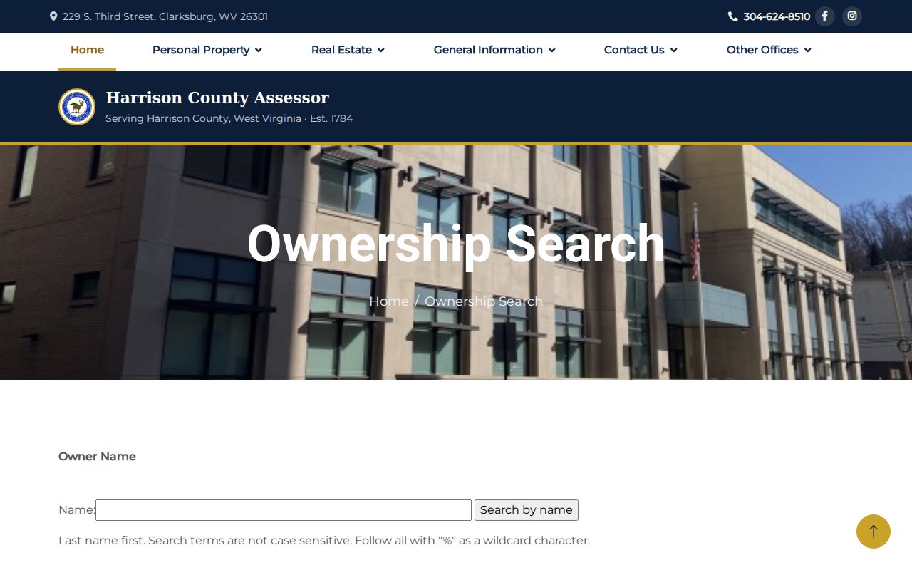
The live form's labels show how to preserve district and parcel components with a result.
Clarksburg Situs Address Records
MapWV draws a vital line between Address and OwnAddr. Address is the situs, meaning the physical location of the parcel. OwnAddr is where the tax owner receives mail. Those fields can match, but often do not. A mailing address may be in another city or state. The situs may also be vacant, used by a business, or held by an entity.
- Parcel
- A mapped unit of land used for assessment. It is not a household record.
- Situs address
- The physical location assigned to the property.
- Plat
- A recorded drawing of lots, roads, or a subdivision.
- Criss-cross directory
- A directory arranged by street and house number instead of only by surname.
The MapWV assessment screen exposes both property and owner-mail fields alongside parcel and deed facts.
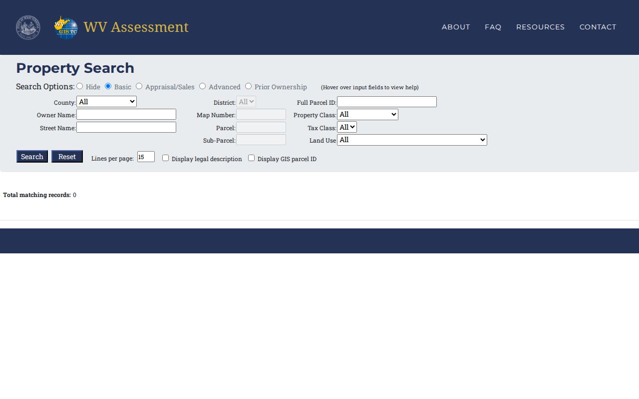
Keeping these labels distinct prevents an owner from being wrongly described as a Clarksburg occupant.
Note: Tax maps support assessment work, but a deed, survey, or plat controls a legal boundary question.
Browse Clarksburg Streets in GIS
The Harrison County GIS viewer lets a researcher move beyond one search result and inspect adjacent parcels, roads, districts, and map context. It is useful when a Clarksburg address is incomplete or when the goal is to build a block list. Click or identify each parcel and carry its district, map, parcel, acreage, and owner label back to the assessment search.
View the official Harrison County GIS entry page.
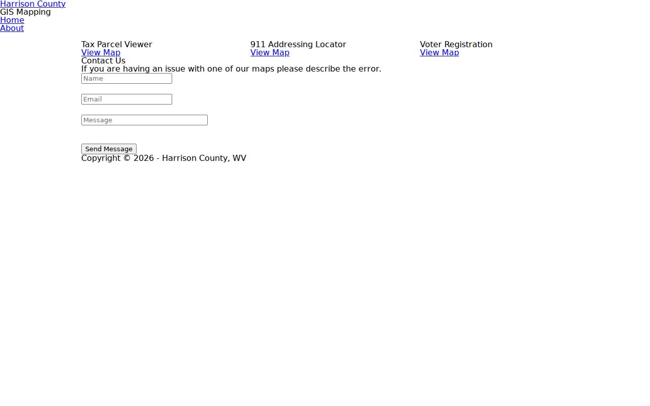
The map adds spatial context, but its parcel shape is not a survey and its owner field is not proof of current residence.
Limited viewer controls make the Root Parcel ID especially useful. If the map fails, the state assessment form and local assessor can still retrieve the parcel by text fields. Keep notes with the search date because assessment data can change.
Clarksburg Street Record Coverage
Each address-keyed source answers a different question. The assessor identifies the tax parcel and listed owner. GIS lays out nearby parcels. Recorded instruments show legal transactions. Postal data standardizes delivery labels, while city and archive sources can explain a building or old address. A sound Clarksburg street directory keeps those meanings apart.
| Record Set | Keeper | What It Shows | Access |
|---|---|---|---|
| Property assessment | Harrison County Assessor and MapWV | Owner, situs, owner mail, parcel, appraisal | Free portals; older coverage not posted |
| GIS parcel map | Harrison County GIS | Roads, districts, parcels, nearby owner labels | Free viewer with limited features |
| Deeds and legal instruments | Harrison County Clerk | Parties, book/page, legal description, transfers | Public index; images vary; clerk supplies records |
| Voter records | Secretary of State and county clerk | Authorized list fields can include residence address | Statutory use limits and request terms apply |
| City permits and code files | Clarksburg departments and City Clerk | Property, project, owner, or concern fields | Forms online; missing history by narrow FOIA request |
| Directories, maps, newspapers | Archives, Waldomore, Library of Congress | Dated street, building, person, and place clues | Selected years; cite volume, issue, or sheet |
The parcel identifier joins assessment and map layers. A deed book and page moves the search into the clerk's index. Street names connect the modern parcel to city files and older sources. When an image is missing, contact the custodian instead of treating the index row as the whole record.
Deeds Along Clarksburg Streets
The Harrison County IDX Search includes name, date, role, subindex, and document-type controls. Historic choices include land books, wills, vital books, military discharges, and road records. For by-address work, begin with a confirmed owner name from the assessor because the deed system is indexed chiefly by parties and instruments, not as a simple street directory.
See the Harrison County IDX interface used for deed research.
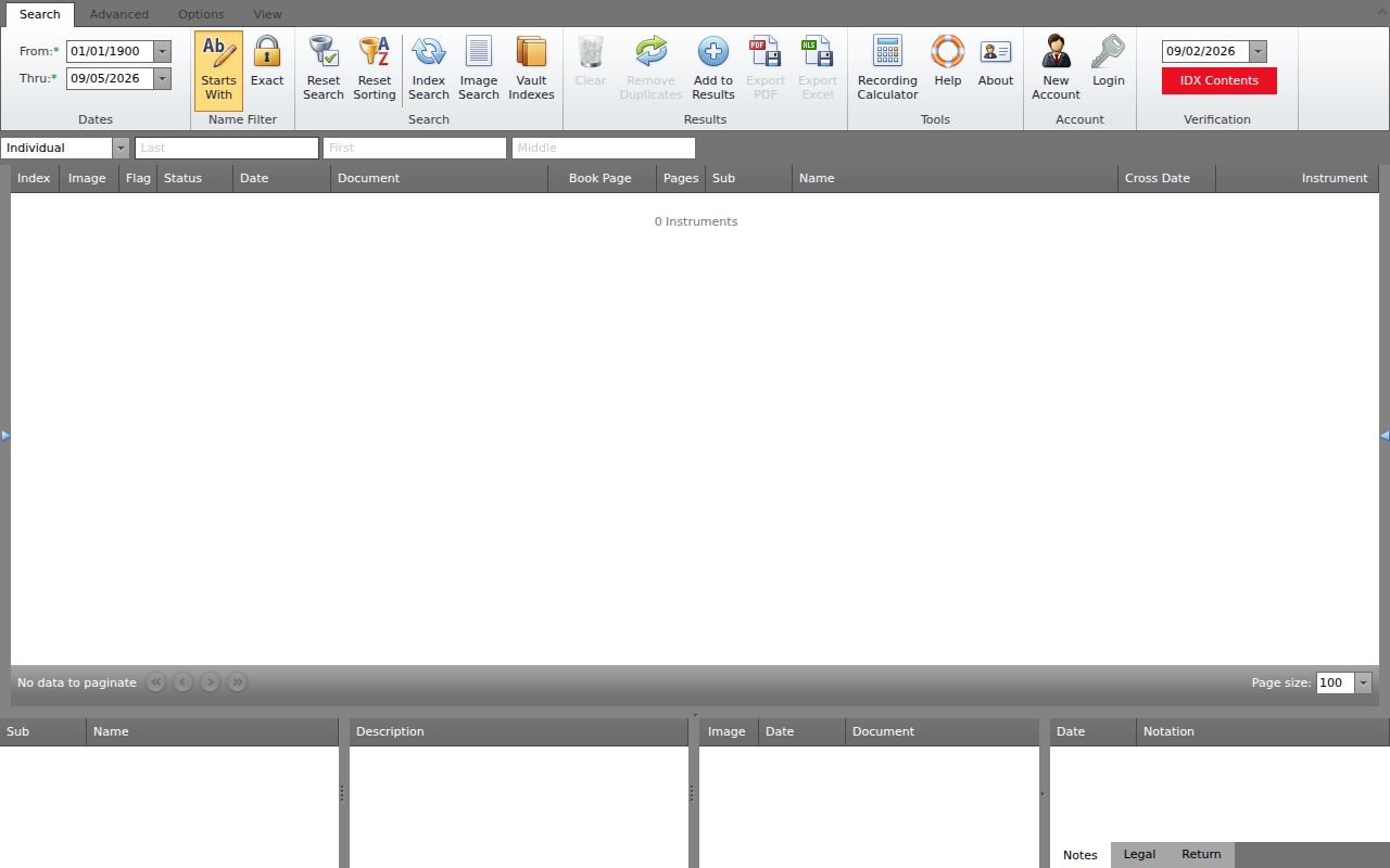
The Search, Advanced, Options, and View areas help narrow a hit, but image access must be checked record by record.
A grantor transfers an interest; a grantee receives it. Capture both roles, the recording date, instrument type, book and page, and the exact legal description. Rights-of-way, releases, deeds of trust, tax deeds, and plats may matter to one parcel, but they should not be merged as if each were a sale. The Harrison County Clerk at 229 S Third Street also provides the counter, phone, and record-copy fallback on weekdays from 8:00 a.m. to 4:00 p.m.
Check the Harrison County Clerk office page before requesting an instrument or certified copy.
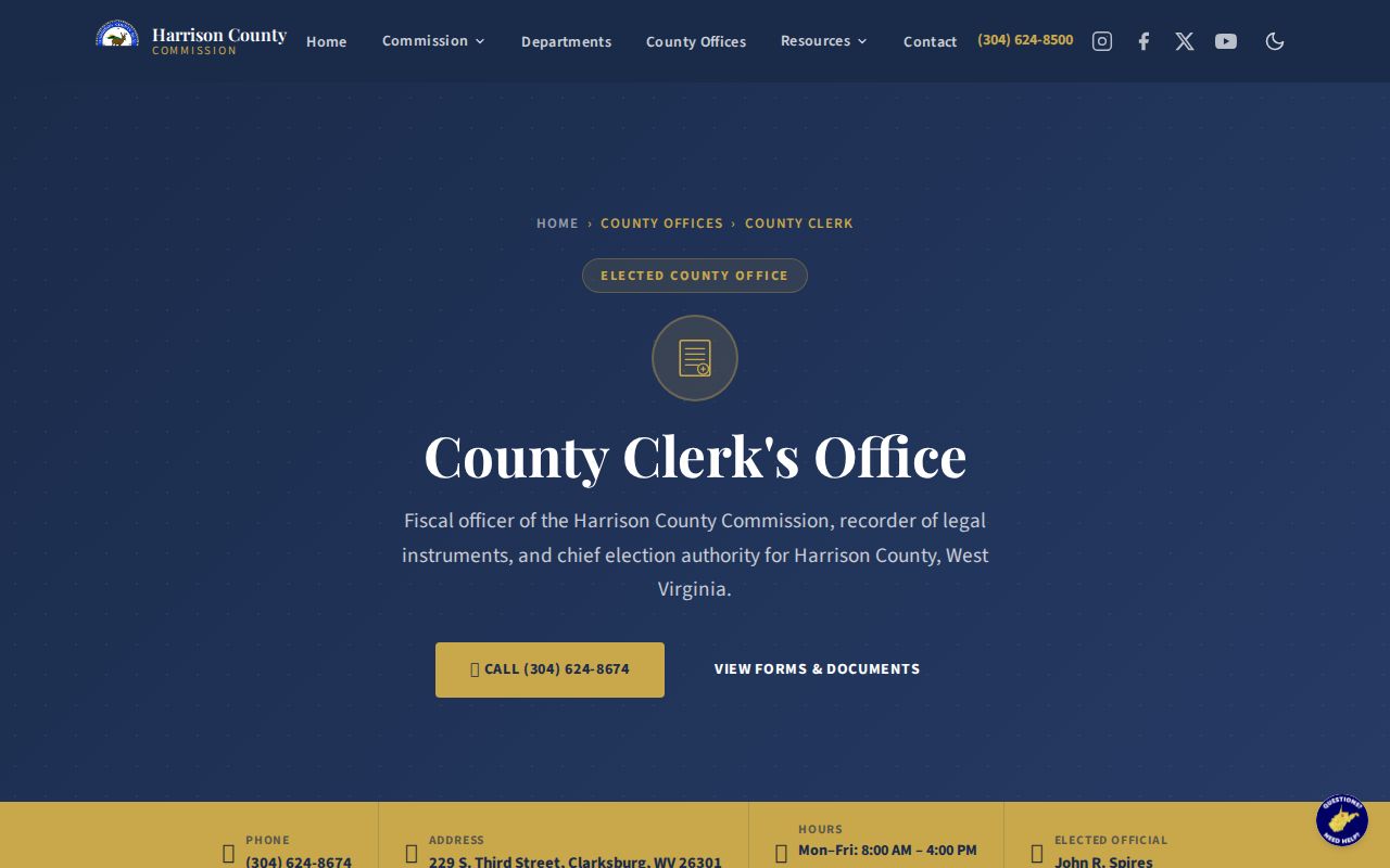
The office page confirms the local counter route when an index image or historic book is not available online.
Clarksburg Street Names Over Time
No official source confirmed a citywide 1912 renumbering, so that claim should not enter an address trail. Clarksburg planning records do describe areas built at different times, haphazard street connections, and a 1917 charter revision that allowed annexation. An old number can only be tied to a new one through evidence such as a deed chain, directory sequence, city map, plat, or legal description.
Library of Congress Sanborn sheets from 1884, 1890, 1911, and 1916 preserve building footprints and older place words. The later sheets name Adamston, Stealey Heights, Broad Oaks, North View, Norwood, Grasselli, Industrial, Point Comfort, Golf Plaza, and New Fair Grounds. A label may mark a district, development, landmark, or industrial site rather than today's municipal boundary.
Wilsonburg adds a postal trap. USPS discontinued ZIP 26461 in 1989 and directed use of Clarksburg 26301. A letter with the former code can still be a sound dated clue, but the postal change does not by itself prove a street, parcel, or person remained the same.
Request Clarksburg Address Files
The Clarksburg permits hub links building, extension, street-closure, vacant-property, and other forms. A complete public historical permit index was not found. When the needed address file is absent, route a narrow written request to the City Clerk or the department named on the form.
Review the city permit routes shown in the captured page.
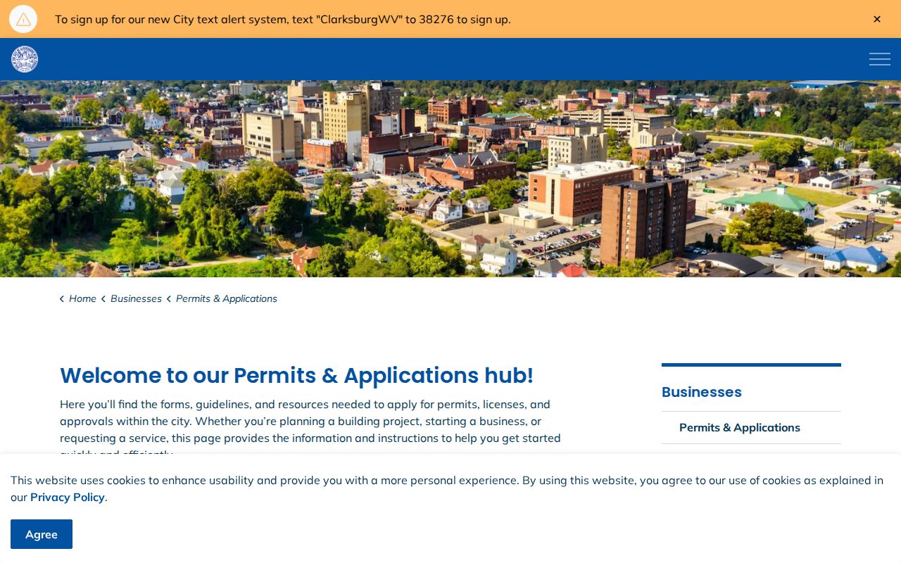
The form list helps identify the likely record keeper before a request is submitted.
Clarksburg's FOIA policy accepts written requests by email, mail, or hand delivery. It does not require a reason. The policy says charges below five dollars are waived, fees may be collected in advance, and the city responds within five city business days. Ask for a defined address, permit type, and date span. Broad requests are less likely to find the exact file.
Note: A permit can document work at a property, but it does not establish who occupied the site.
Clarksburg Street Directory Archives
For past households, ask Waldomore whether a street-order, criss-cross, or telephone directory is held under another catalog title. The public page confirms city-directory and genealogy help, but it does not publish a separate reverse-directory title or its years. That gap matters. Do not promise a shelf that has not been confirmed.
The official State Archives year list begins with a combined 1900-01 volume and continues through selected years to 2016. Use the Clarksburg city directory collections for the full inventory and reading method. Once a street entry is found, cite the edition and page, then test it against a census, deed, obituary, or dated newspaper.
Historic directories are snapshots, not current rolls. A name may be absent because the person moved, died, was omitted, or lived in a household listed under someone else. Older contact data should not be republished as if it were live.
Limits of Clarksburg Street Records
A Clarksburg street directory search cannot produce a complete household list. Assessment records identify tax owners, not all occupants. A deed names people in legal roles and may be years old. USPS standardizes an address but says that result does not confirm a person or company there. West Virginia voter data has statutory limits, and protected or confidential records stay outside a street search.
Utility customer details are not a public substitute for occupancy proof, and motor-vehicle address information is restricted by federal law. West Virginia's Address Confidentiality Program provides a substitute address for eligible survivors. Never try to uncover a protected residence or work around a sealed source.
Lawful use. Use Clarksburg address records only for lawful personal research. Never use a street result to stalk, harass, threaten, or expose a protected person.
The right conclusion is often narrow: a source associated a named owner, voter, business, or household with an address on a stated date. If the purpose shifts to confirming one person across modern records, use the Clarksburg resident lookup workflow and preserve each role separately.